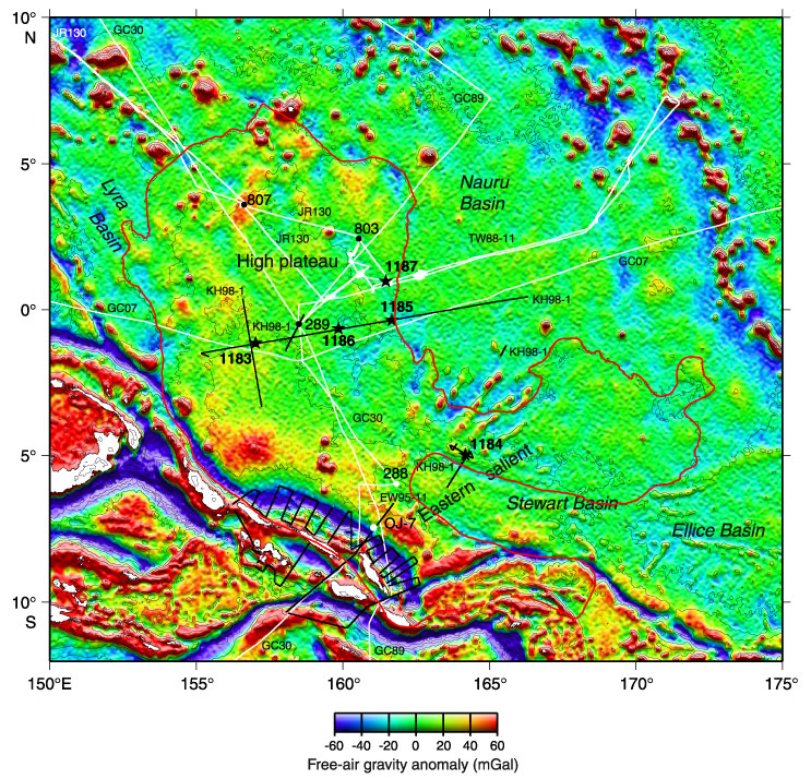
Figure F2. Satellite-derived free-air gravity map of the Ontong Java Plateau region (after Sandwell and Smith, 1997). The plateau is outlined. Stars show locations of Site 1187 and other Leg 192 sites. Black dots = previous ODP and DSDP drill sites that reached basement; white dots = Site 288, which did not reach basement but bottomed in Aptian limestone, and Site OJ-7, which was proposed for Leg 192 but not drilled. Black lines = surveys providing multichannel seismic control: Hakuho Maru KH98-1 Leg 2 (1998) and Maurice Ewing EW95-11 (1995). White lines = surveys providing single-channel seismic control: Glomar Challenger Leg 7 GC07 (1969), Glomar Challenger Leg 30 GC30 (1973), Glomar Challenger Leg 89 GC89 (1982), Thomas Washington TW-11 (1988), and JOIDES Resolution Leg 130 JR130 (1990). The bathymetric contour interval is 1000 m (IHO/IOC, 1997).
![]()