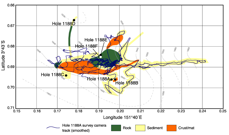
Figure F3. Calculated course of the vibration-isolated television (VIT) during the site survey prior to the spudding of Hole 1188A, and observed seafloor character. Bathymetric contours (5-m intervals) within the survey area are based on VIT cable measurement and sonar altimetry, calibrated to the actual drill pipe measurement depth of Hole 1188A. Contours outside the survey area are derived from submersible dives and have been added to show the general topography of the Snowcap hydrothermal site. Only the track from the initial survey is shown, but additional seafloor cover information from other surveys has been added. The Global Positioning System averaged locations for all of the holes at Site 1188 are also shown.
![]()