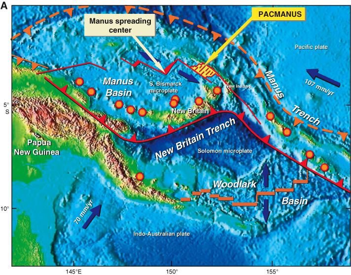
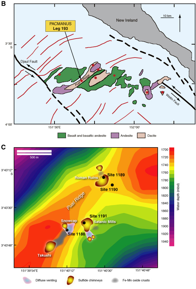
Figure F1. A. Location and geologic setting of the PACMANUS hydrothermal field (modified from Shipboard Scientific Party, 2002a). Seafloor bathymetry basemap from
www.ngdc.noaa.gov/mgg/image/2minsurface/1350/00N135E.jpg. Inactive (dashed orange line with teeth on overriding plate) and active (red solid line with teeth on overriding plate) subduction zones encompass the Manus spreading center between Papua New Guinea and New Britain to the south and New Ireland to the north. The PACMANUS area lies between transform faults east of the Manus spreading center. Sites of nearby active volcanism are marked by orange serrated circles. Thick blue arrows indicate plate motions, and the orange bars spanning Woodlark Basin indicate spreading segments. B. Seafloor geology of PACMANUS area (yellow shaded area in Fig. F1A) in the Eastern Manus Basin (modified from Binns, Barriga, Miller, et al., 2002). Red circles = locations of known hydrothermal sites, red lines = extensional fault scarps. C. Active hydrothermal areas and drill sites at PACMANUS.