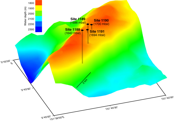
Figure F2. Three-dimensional shaded-relief image (10x vertical exaggeration) along Pual Ridge (bathymetry data from Lee, 2000). Image shows the relative locations and depth to seafloor of Sites 1188 (Snowcap), 1189 (Roman Ruins), 1190 (reference site), and 1191 (Satanic Mills). Shaded lines beneath holes indicate relative depth of penetration at each site.