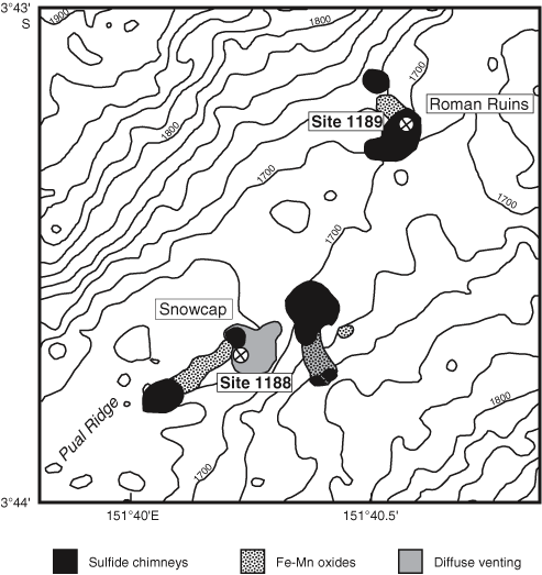
Figure F2. Distribution of hydrothermal deposits within the PACMANUS field along the crest of Pual Ridge and location of ODP Leg 193 drill hole sites. The map is based on bottom-tow photography and submersible dive observations from several PACMANUS cruises (modified after Binns, Barriga, Miller, et al., 2002).