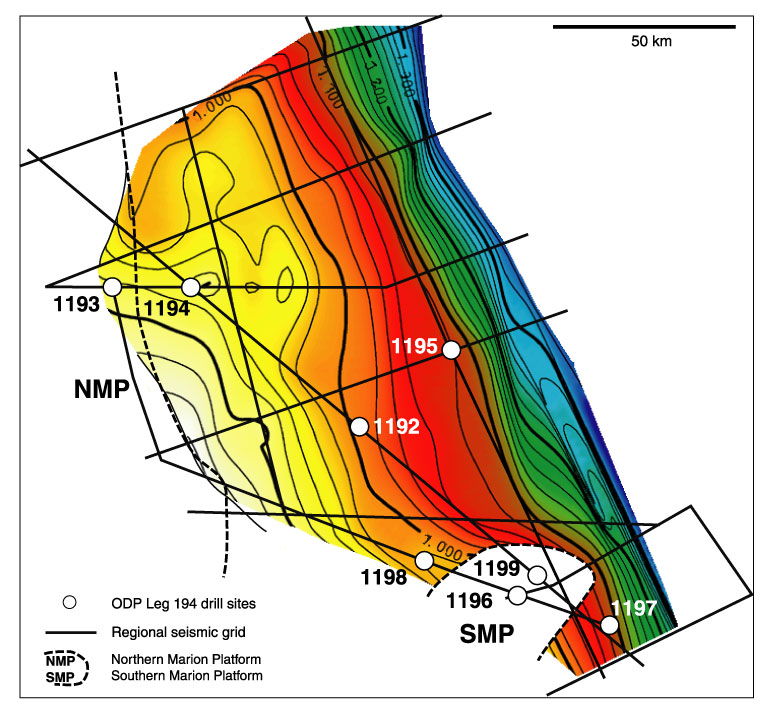
Figure F3.
Topography of acoustic basement in the area covered by the Leg 194 site survey.
Topography is given in two-way traveltime and is not depth corrected. Basement
cannot be mapped below the carbonate platforms because scattering and
attenuation of the platform top hinders penetration of the seismic signal. Fine
lines are spaced every 20 ms, which equals ~20 m.