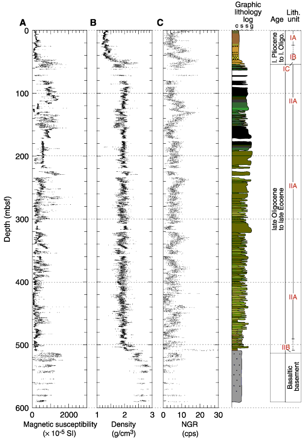
Figure F21. Laboratory multisensor track measurements of (A) magnetic susceptibility, (B) density, and (C) natural gamma ray emission vs. depth at Site 1201. In the graphic lithology log, c = clay, s = silt, s = sand, g = gravel.