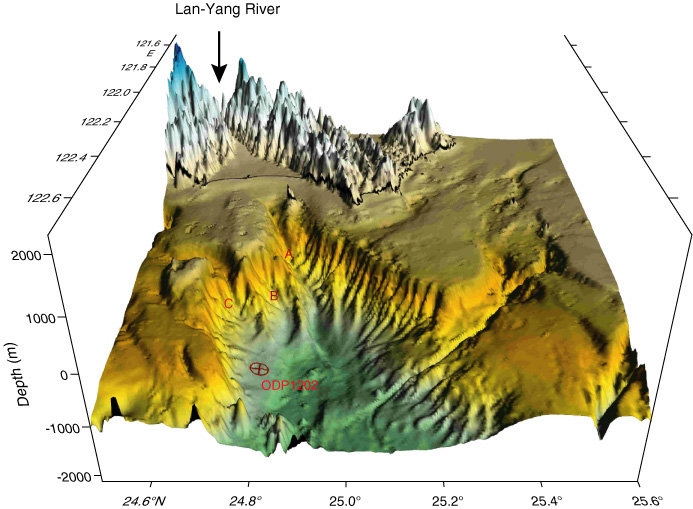
Figure F2. Topography of the Southern Okinawa Trough and northeast corner of Taiwan looking from the axis of the trough toward the Lan-Yang River and its delta plain on northeast Taiwan. The map was generated from the digital data compiled in Liu et al. (1998) with exaggerated elevation. The location of Site 1202 is marked by the red circle-cross symbol. Three canyons (A, B, and C) indicate major conduits that supply sediments to the southern Okinawa Trough.