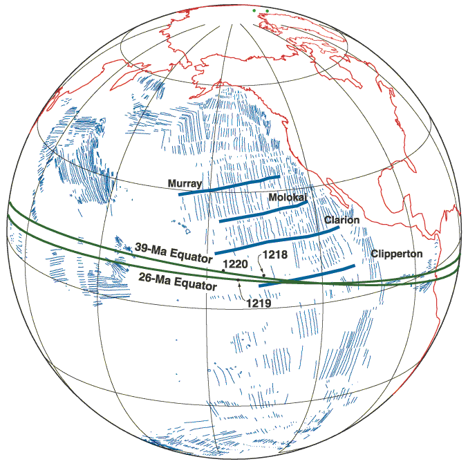
Figure F13. Relative position of the paleoequator for the middle Eocene and late Oligocene based on data from Sites 1218, 1219, and 1220. The main seafloor magnetic anomalies as well as the major fracture zones are shown in blue. For each site, we have computed a mean declination and inclination for two different intervals, 26 and 39 Ma. Mean declinations have then been rotated for the expected paleomagnetic pole for the Pacific plate of the appropriate age. The map was constructed using GMAP32 (Torsvik and Smethrust, 1989-1997).