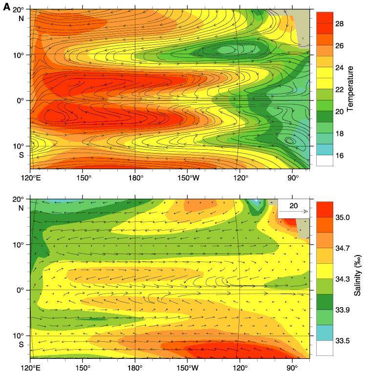
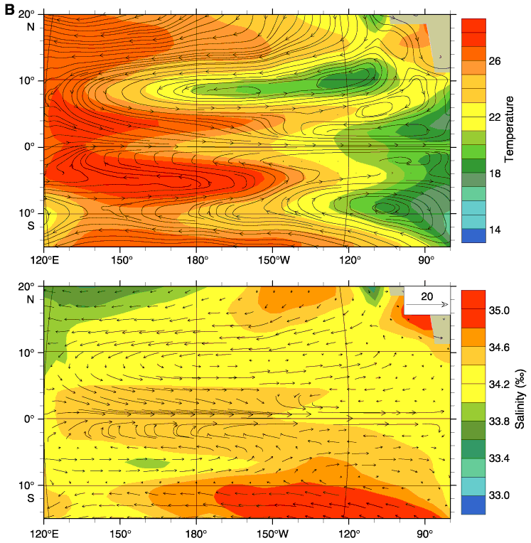
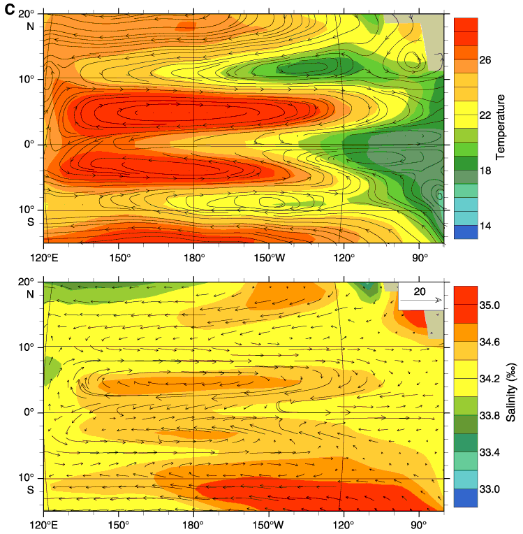
Figure F4. A. The annual average temperature and streamlines (top) and salinity and current vectors (bottom) for the thermocline layer (60-160 m). B. AMJ temperature and streamlines (top) and AMJ salinity and current vectors (bottom) at 60-160 m. C. OND temperature and streamlines (top) and OND salinity and current vectors (bottom) at 60-160 m.