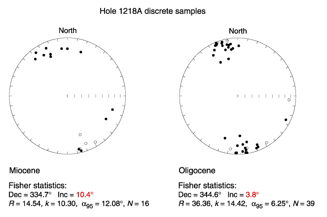
Figure F11. Equal area stereoplots of the ChRM directions calculated from discrete samples from Hole 1218A. The samples were divided into two sets according to their age (Miocene and Oligocene). Notice the coexistence of both north and south downward-pointing and shallow-magnetization directions, revealing the equatorial position of these sediments. Dec = declination, Inc = inclination,  95 = 95% confidence interval, k = Fisher precision parameter, R = length of vector, N = number of samples, solid circles = lower hemisphere, open circles = upper hemisphere.