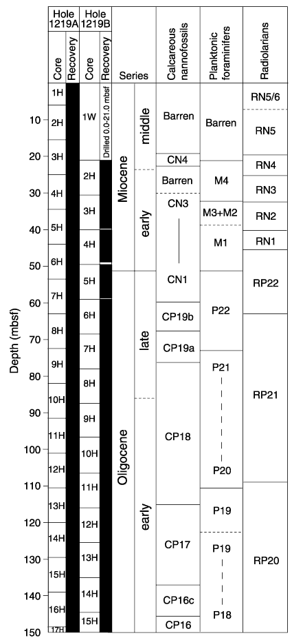
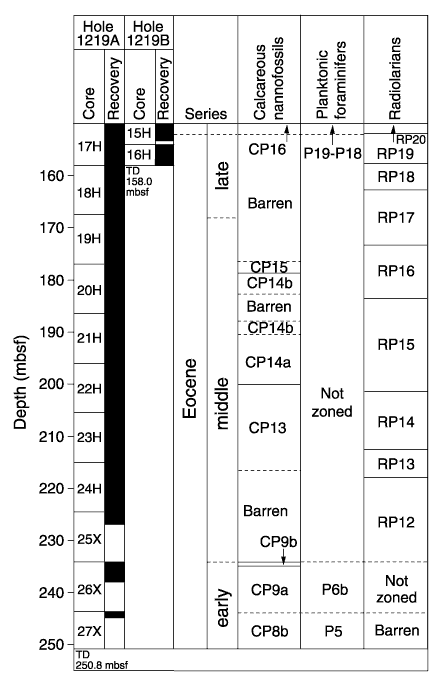
Figure F11. Biostratigraphic zonation for Site 1219. Horizontal dashed lines indicate that a boundary can only be approximated by available biostratigraphy. Vertical dashed lines show intervals where the absence of intervening zonal markers prevents further subdivision of the zonation. TD = total depth.