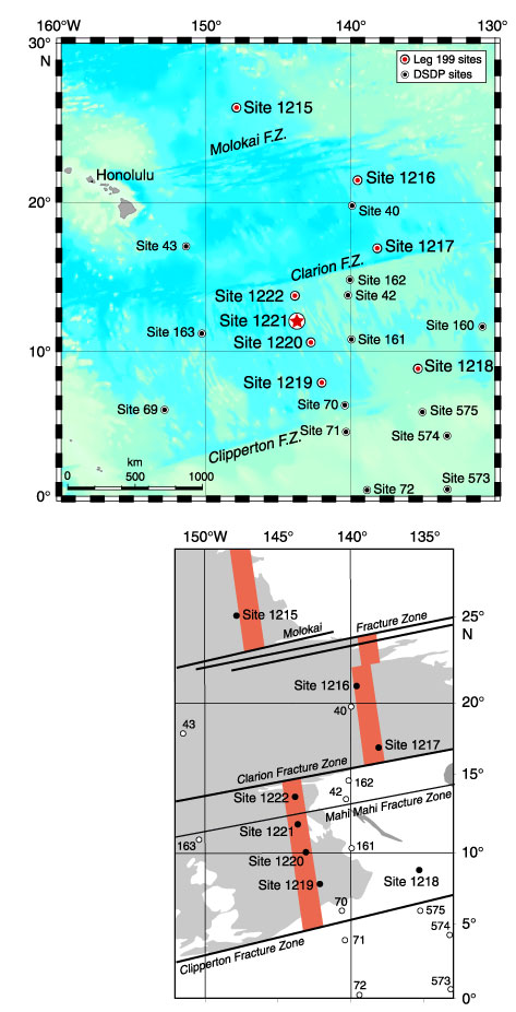
Figure F1. Location of Site 1221 in the Leg 199 transect. The top map shows Site 1221 on the regional bathymetry. The bottom map shows the transect target crust. In the lower panel, gray shading = seafloor depths >5000 mbsl, red shading = approximate position of the nominal target crust of the 56-Ma transect. FZ= fracture zone.