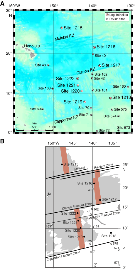
Figure F3. Map of the central tropical Pacific showing (A) Leg 199 drill sites and Deep Sea Drilling Project (DSDP) drill sites on regional bathymetry, and (B) Leg 199 drill sites superimposed on the approximate position of magnetic Anomaly An25n (58.9–56.4 Ma, red), the target crust for the 56-Ma transect. Gray shading = seafloor depths >5000 m. F.Z. = fracture zone.