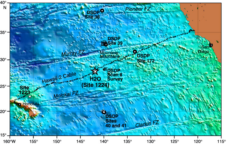
Figure F1. Locations are shown of Site 1224 and the Hawaii-2 Observatory (H2O) junction box (large star), Site 1223 (small star), repeater locations along the Hawaii-2 cable (crosses), major fracture zones (FZ), and previous drill sites (circles) from DSDP Legs 5 (Sites 38, 39, 40, and 41) and 18 (Site 172). Superimposed on the map is the satellite-derived bathymetry.