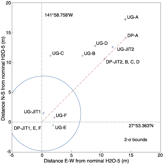
Figure F3. All of the drilling activity at the H2O occurred within a 20-m x 20-m area. The ship took up three positions by dynamic positioning (DP): the first jet-in test (JIT) and Holes 1224E and 1224F (DP-JIT1, E, and F), the first coring site (DP-A), and the site of the second jet-in test and Holes 1224B, 1224C, and 1224D (DP-JIT2, B, C, and D). Averages of the navigation fixes during each of these activities were computed in the underway geophysics laboratory and are denoted UG-A, UG-B, and so forth, for the various holes and jet-in tests. The circle shows the typical 2- bounds for the scatter in the navigation fixes.