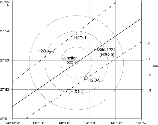
Figure F1. All drilling activities at the Hawaii-2 Observatory (H2O) took place within 20 m of Site 1224 (see Figure F3 of Shipboard Scientific Party, 2003), which is 1.48 km northeast of the broadband seismometer at the H2O junction box. Alternate drilling sites (H2O-1 through H2O-4) discussed in the Leg 200 Scientific Prospectus are also shown (circles with crosses). Circles are drawn at 1, 2, and 3 km radii from the H2O junction box. Also shown are the locations of the single-channel seismic lines acquired during the site survey cruise in 1997 (dashed lines) (Stephen et al., 1997) and the track line taken by the JOIDES Resolution on 26 December 2001 (solid line).