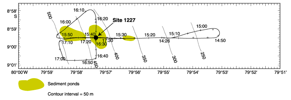
Figure F1.
Track line for 3.5-kHz survey in the vicinity of Site 1227. Time points are in Universal Time Coordinated, contours are fit to precision depth recorder measurements, and the extent of sediment patches are estimated from crossing lines.