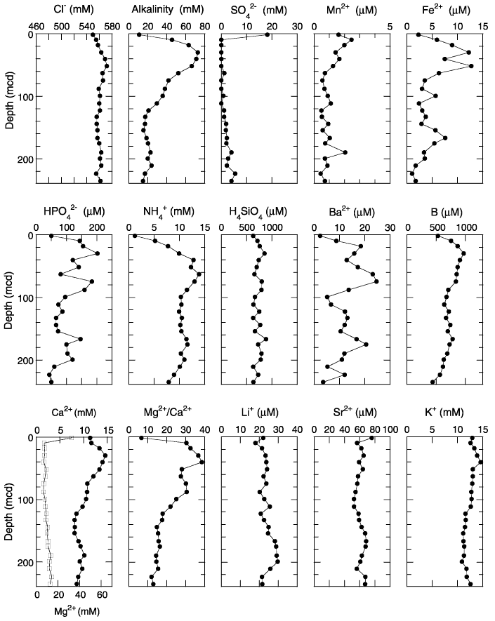
Figure F22.
Interstitial water geochemical data, Site 1234. Sulfate values below the detection limit (~0.6 mM) are plotted at zero. Open squares = calcium concentrations.