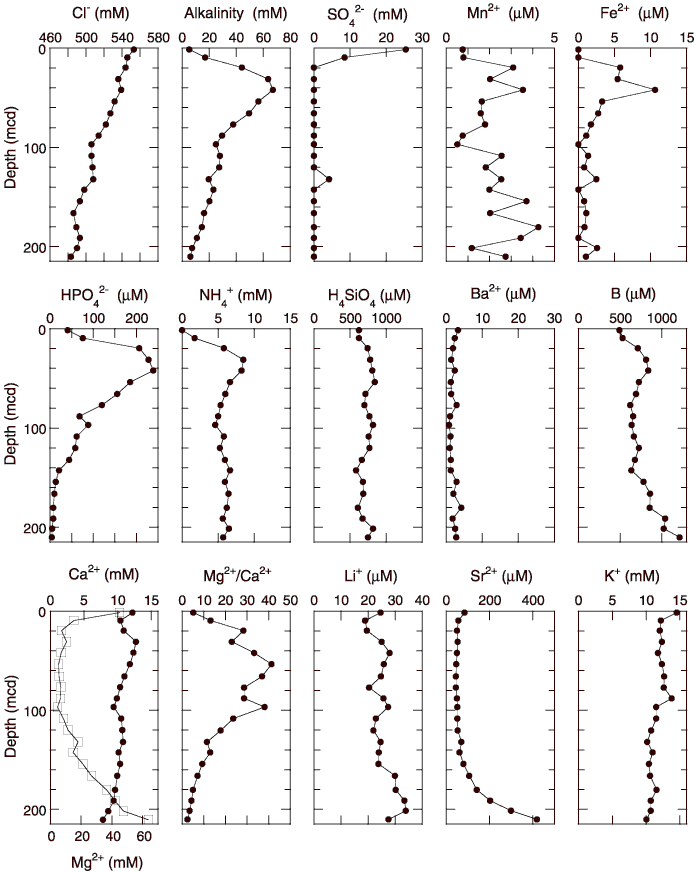
Figure F26.
Interstitial water geochemical data, Site 1235. Values below the detection limits (0.6 mM for sulfate, 0.5 µM for iron, and 0.3 mM for ammonium) are plotted at zero. Open squares = calcium concentrations.