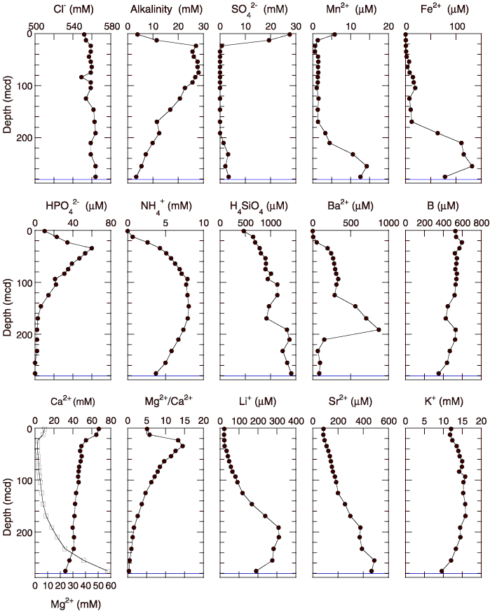
Figure F27. Interstitial water geochemical data for Site 1242. Open squares = calcium concentrations. Horizontal line indicates the lithologic unit boundary (see
"Description of Lithologic Units" in "Lithostratigraphy"). Values below the detection limits (sulfate = 0.6 mM, phosphate = 0.2 µM, ammonium = 0.42 mM, and barium = 0.1 µM) are plotted at zero.