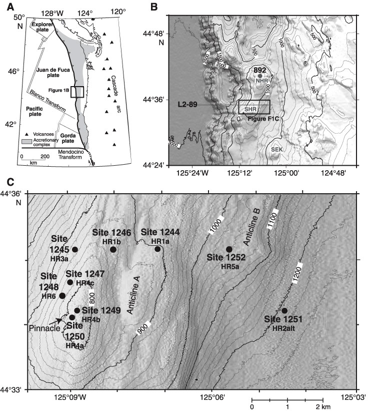
Figure F1. A. Tectonic setting of Hydrate Ridge in the accretionary complex of the Cascadia subduction zone. The box shows region of (B). B. Bathymetric map of the Hydrate Ridge vicinity. The box shows location of (C). Locations of ODP Site 892, seismic line L2-89 (shown in Fig. F2), north Hydrate Ridge (NHR), south Hydrate Ridge (SHR), and Southeast Knoll (SEK) are also shown. C. Detailed bathymetric map of the region south of Hydrate Ridge. Leg 204 sites are shown along with their site numbers (e.g., Site 1244) and precruise designation (e.g., proposed Site HR1a). Bathymetry from Clague et al. (2001).