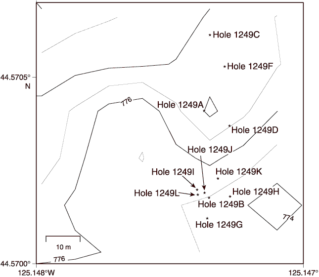
Figure F1.
Bathymetric map showing locations of holes drilled at Site 1249. Bathymetry from EM300 data acquired by Monterey Bay Aquarium Research Institute (MBARI) (Clague et al., 2001).