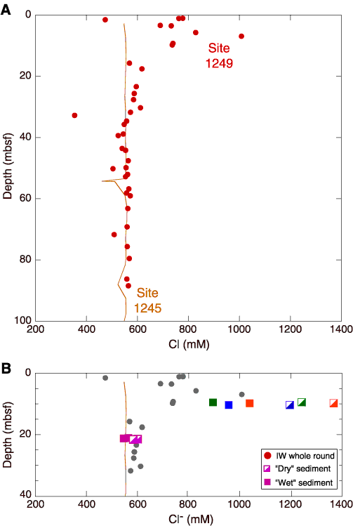
Figure F14. Chloride (Cl-) concentration profile at Site 1249 (red circles) is shown with data from Site 1245 (fine orange line) for comparison. A. Chloride concentration data below ~30 mbsf show excursions to fresher values as defined by a vertical baseline of chloride values from Site 1245. Chloride data above 15 mbsf show positive chloride anomalies with respect to the vertical baseline. We infer that these saltier pore waters result from gas hydrate formation at rates that exceed those of salt removal by diffusion and advection. B. Chloride concentration in pore fluids collected from whole-round samples (gray circles) and data from special samples collected to quantify the difference between dry-looking and wet-looking sediment textures (see Table T5) in the upper 40 mbsf. Fine orange line represents Cl- concentrations measured in samples from Site 1245. The color-coded closed and half-open squares identify sample pairs taken in close proximity to one another within either dry or wet sediment. In all cases, the dry-looking samples have significantly higher dissolved chloride than the wet-looking samples. The wet-looking samples also have a higher water content (Table T5). These data clearly identify the presence of a brine in the upper 10 mbsf. IW = interstitial water.