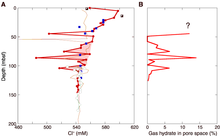
Figure F17. Chloride (Cl-) concentration profiles and gas hydrate estimates based on these chloride data at Site 1250. A. Chloride data (red circles) are shown with data from Site 1245 (fine orange line) for comparison. Chloride concentration data from Holes 1250B (closed red circles), 1250C (closed blue squares), 1250E (semiopen black squares), and 1250F (open green circles). For comparison, the chloride profile from Site 1245 (fine, brown line) is also shown. Note that in the upper 40 mbsf, the chloride concentrations are commonly above seawater values (~560 mM). Below 50 mbsf, the chloride data form a sloping baseline toward slightly fresher values similar to that of Site 1245. There are no anomalies in the chloride concentration below 110 mbsf. B. Estimates of the amount of gas hydrate in the sediments of Site 1250. No gas hydrate estimates given above 50 mbsf because the chloride concentration of in situ pore water is unknown. Below 50 mbsf, the establishment of a firm chloride baseline allows a first-order estimate of gas hydrate amounts that peak at 15% of pore space but commonly range between 0% and 6%.