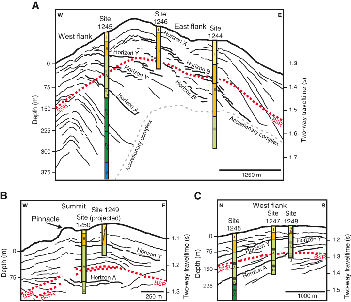
Figure F2. Line drawings from three-dimensional multichannel seismic profiles (Tréhu, Bohrmann, Rack, Torres, et al., 2003) corresponding to (A) west–east section across the northern part of southern Hydrate Ridge, (B) west–east section across the summit of southern Hydrate Ridge, and (C) north–south section along the west flank of southern Hydrate Ridge. The bottom simulating reflector (BSR) and main seismic horizons are indicated, as well as the Leg 204 borehole distribution in lithostratigraphic units of the drilled sites. Thick black rectangles = stratigraphic intervals studied in this data report.