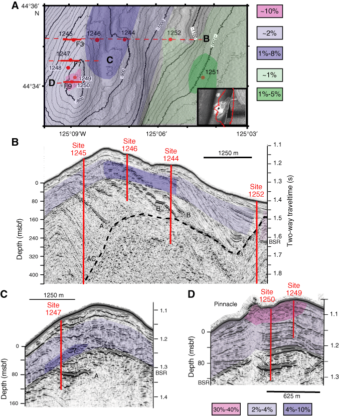
Figure F1. A. South Hydrate Ridge and locations of drilling sites. Overlay shows gas hydrate content of the pore space averaged between the seafloor and bottom-simulating reflector (BSR). Inset shows seafloor reflectivity at the summit (from Tréhu et al., 2004b). B, C, D. Seismic cross sections through South Hydrate Ridge showing the setting of drill site. Slices were extracted from a 3-D seismic survey that is discussed in detail in Chevallier et al. (this volume). Overlay shows average gas hydrate content of the pore space (from Tréhu et al., 2004b). A zone located immediately above the BSR at Site 1247 that is enriched in gas hydrate relative to the regional average was not included in the Trehu et al. (2004b) model but has since been recognized based on sonic logs (Guerin et al., this volume) and chloride concentration anomalies (Bangs et al., 2005).