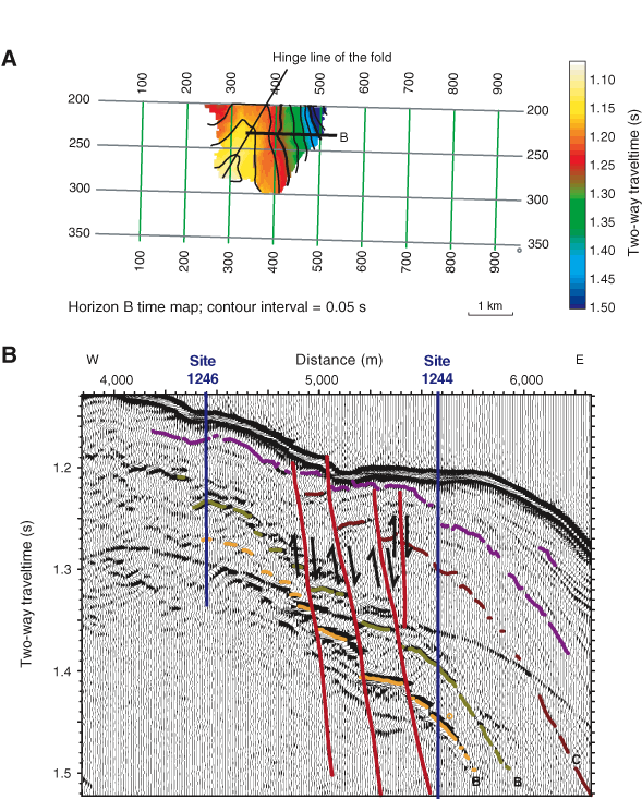
Figure F9. A. Time map to Horizon B showing a northeast-plunging anticline. This is interpreted to result from reactivated uplift of southern Hydrate Ridge (SHR). The location of the seismic section shown in part B is indicated by a thick black line. B. Detail of seismic data from 3-D Line 230 near Sites 1244 and 1246 showing normal faulting in Units S.II and S.IB. This faulting appears to be syndepositional and to continue to the seafloor, which shows a pattern of small northeast-trending ridges in this region (Johnson et al., 2003). These faults appear to provide pathways for migration of gas hydrate into the GHSZ, as indicated by relatively large but laterally variable gas hydrate content (Tréhu et al., 2004a) and the absence of a double BSR (Bangs et al., 2005) in this region.