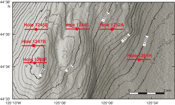
Figure F1. Map of southern Hydrate Ridge, offshore Oregon, and location of the sites where sonic logs were recorded during Leg 204. The red straight lines across each site indicate the extent of the 3-D seismic data displayed for each site in subsequent figures.