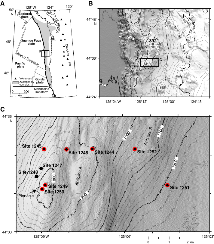
Figure F1. A. Location map and tectonic setting of Hydrate Ridge. Inset shows region of (B). B. Bathymetry of the Hydrate Ridge vicinity Inset shows the location of (C). SHR = southern Hydrate Ridge. NHR = northern Hydrate Ridge. SEK = Southeast Knoll. C. Locations of ODP Site 892 and those drilled during Leg 204. Sites where acetate and hydrogen concentrations were measured are noted in red and solid circles. Figure modified from Tréhu, Bohrmann, Rack, Torres, et al. (2003) and Shipboard Scientific Party (2003).