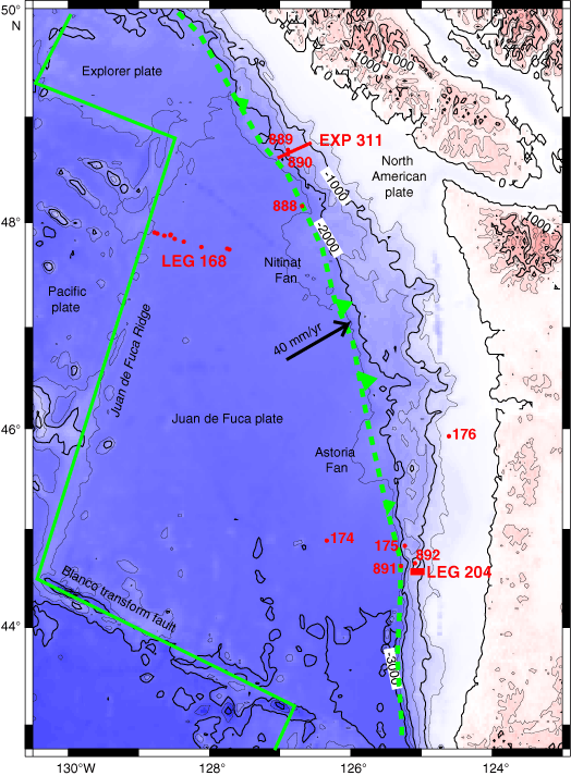
Figure F1. A. Regional bathymetric map showing the locations of sites drilled during DSDP Leg 18 (Sites 174–176), ODP Leg 146 (Sites 888–892), ODP Leg 204, and IODP Expedition 311. Individual sites are not shown for Leg 204; the red box shows the location of the map in Figure F2A. Plate boundaries and the relative motion vector between the Juan de Fuca and North America plates are also shown.