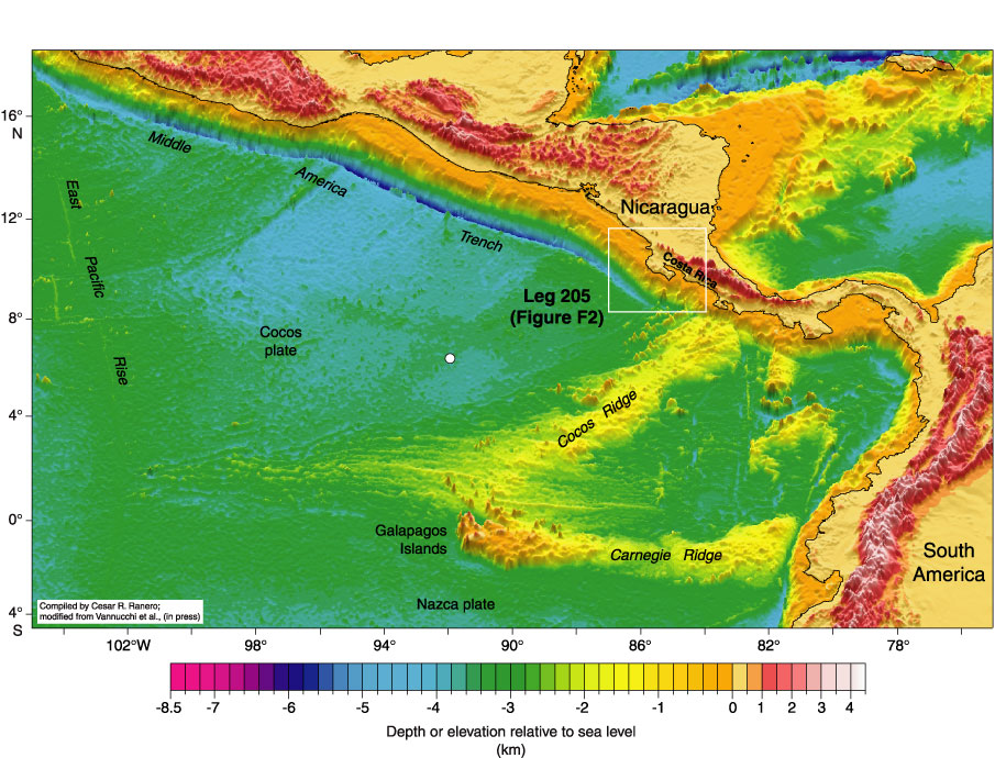
Figure F1. Bathymetric map of the eastern central Pacific showing the location of the Leg 205 drilling area in the Middle America Trench offshore Costa Rica. The white box shows the location of the map in Figure F2. The white circle denotes the location of the Leg 206 site. The map is modified after Vannucchi et al. (in press) based on a data compilation of C.
Ranero.