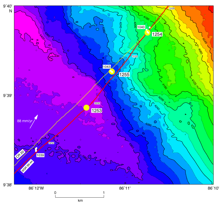
Figure F1. Drill sites occupied during Leg 205 are shown as yellow circles and those during Leg 170 drill sites as white circles. The segment of multichannel seismic profile BGR 99-44 (red line) across Sites 1254 and 1040 is shown in Figure F2. Leg 170 drill sites were based on seismic profile CR-20 (yellow line). Bathymetric map is an integration of the compilation by Ranero and von Huene (2000) and Simrad data from E. Flueh (pers. comm., 2000). The plate convergence direction is N30°E (arrow).