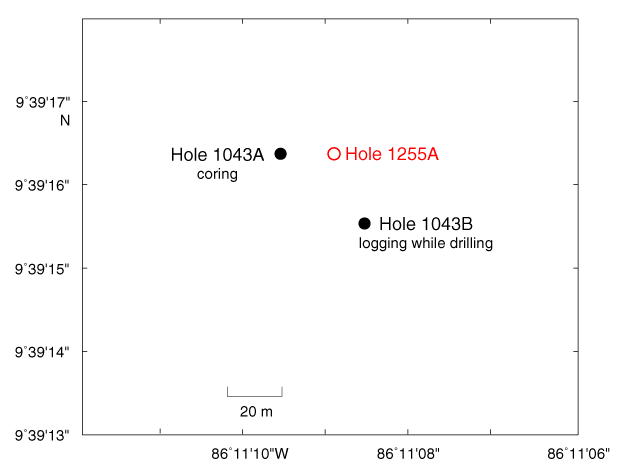
Figure F2. Location of Site 1255. Open circle = drill site occupied during Leg 205, solid circles = drill sites occupied during Leg 170. Bathymetric map is an integration of the compilation by Ranero and von Huene (2000) and Simrad data from E. Flueh (pers. comm., 2000).