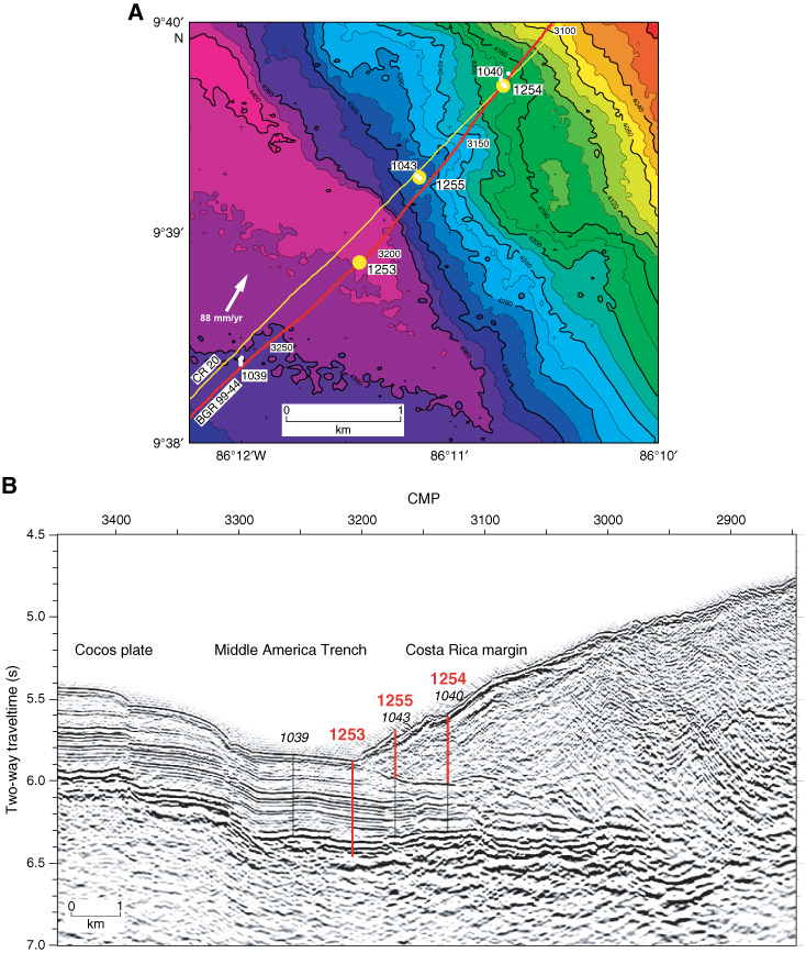
Figure F1. A. Bathymetric map of Leg 205 and 170 transects with borehole locations. B. Seismic line showing Leg 170 drill Sites 1039, 1040, and 1043 and Leg 205 drill Sites 1253, 1254, and 1255 adapted from Morris, Villinger, Klaus, et al., 2003. CMP = common midpoint.