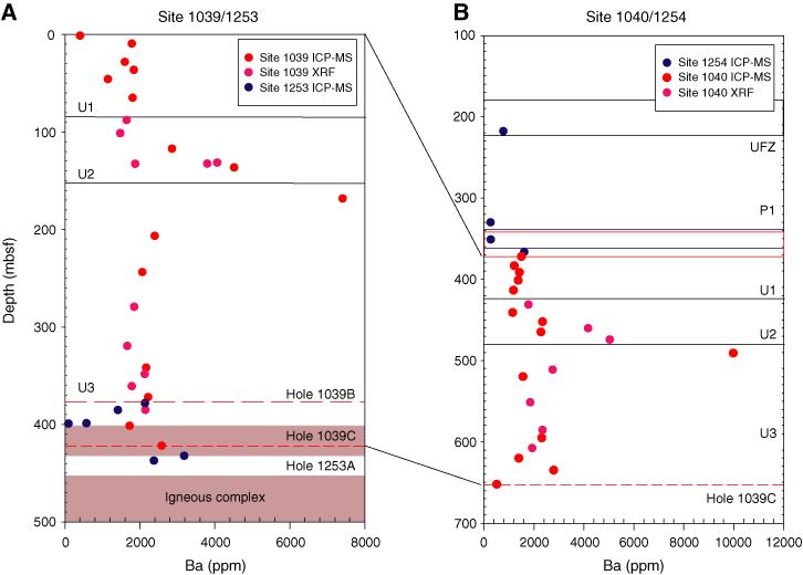
Figure F4. Bulk sediment Ba concentration-depth profiles at (A) Sites 1039/1253 and (B) Sites 1040/1254. Dashed red lines in A are the sill depths in Holes 1039B and 1039C. The thin gray shaded area is the sill at Site 1253, and the thick gray shaded area is the igneous complex. The black line in B is the upper fault zone (UFZ), the area delineated by blue lines is the décollement at Site 1254, and the area delineated by solid red lines is the décollement at Site 1040. X-ray fluorescence (XRF) data are from Kimura, Silver, Blum, et al. (1997). ICP-MS = inductively coupled plasma–mass spectrometry.