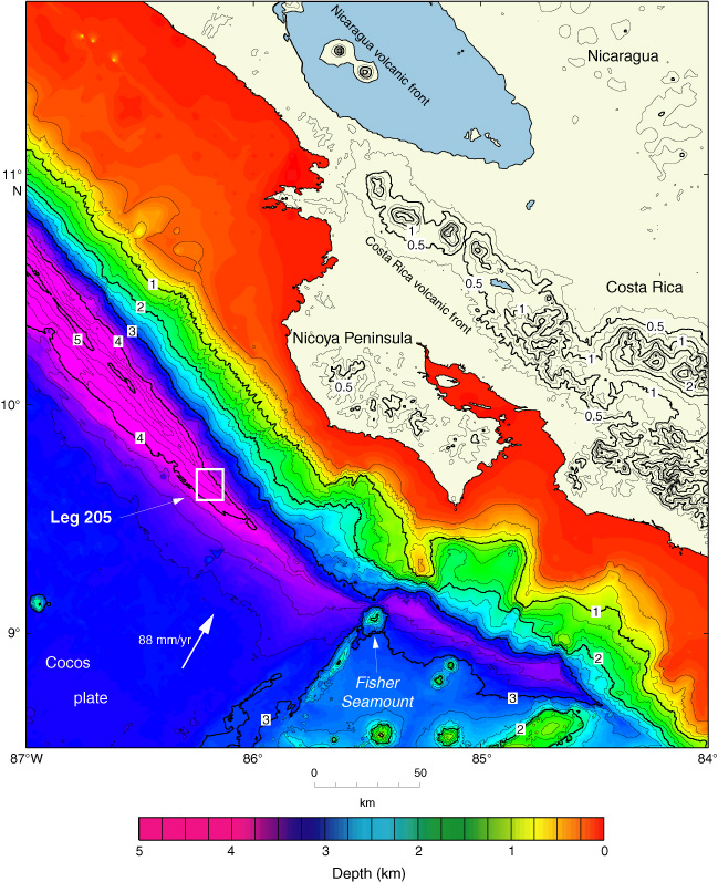
Figure F2. Bathymetric map of the Middle America Trench offshore the Nicoya Peninsula, Costa Rica. White box shows the location of the Leg 205 drilling area. Bathymetry is from Hydrosweep (Ranero and von Huene, 2000) and Simrad (E. Flueh, pers. comm., 2002) swath mapping data combined with ETOPO5. Note position of Fisher Seamount (from Morris, Villinger, Klaus, et al., 2003).