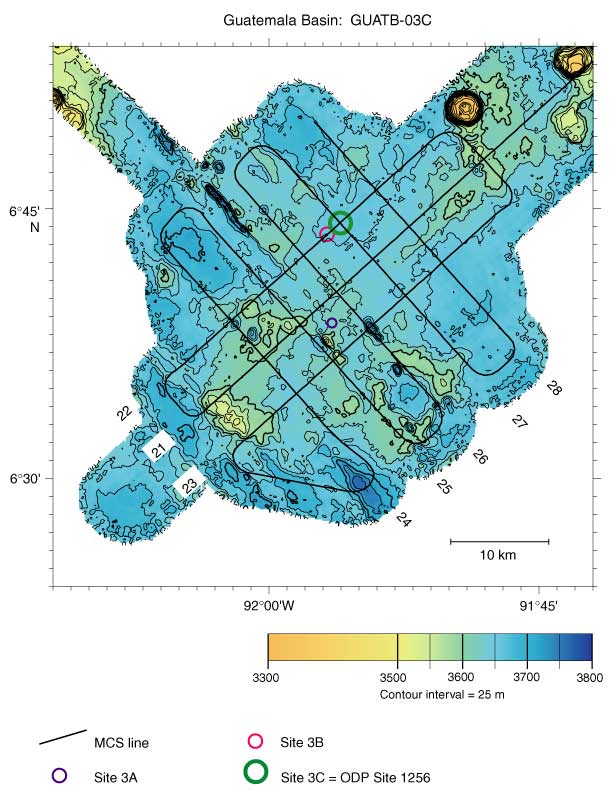
Figure F10. Bathymetry and site survey track map for Site 1256 (proposed Site GUATB-03). Abyssal hill relief of up to 100 m is apparent in the southwest part of the area; relief to the northeast is lower and less organized. Line numbers 21-28 identify multichannel seismic (MCS) lines for subsequent figures.