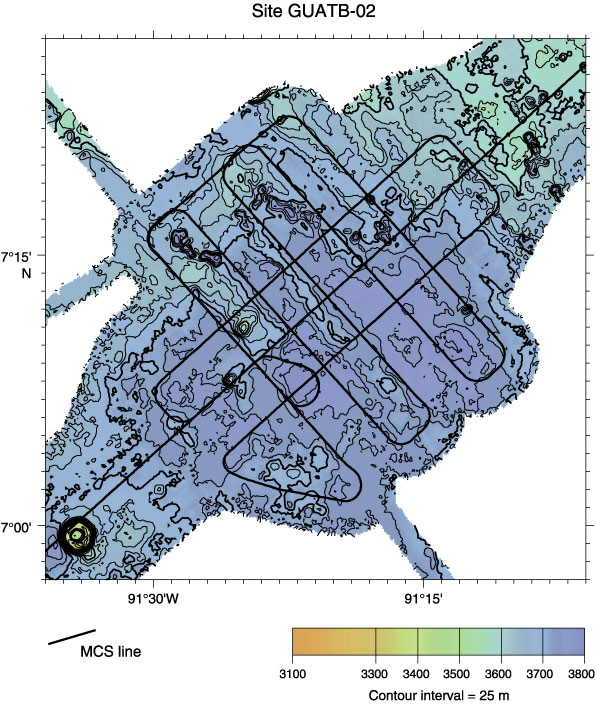
Figure F11.
Bathymetry and site survey multichannel seismic (MCS) track map for proposed Site GUATB-02. Abyssal hill relief of ~100 m is more pronounced than for most nearby regions.