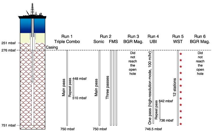
Figure F188.
Details of the logging operations in Hole 1256D. Depths are shown in meters below seafloor (mbsf). FMS = Formation MicroScanner, BGR = BGR magnetometer, UBI = Ultrasonic Borehole Imager, WST = Well Seismic Tool.