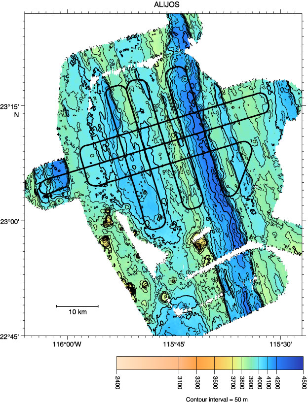
Figure F40.
Multibeam bathymetry contour map and multichannel seismic (MCS) track map for grid 4 (data bank Site ALIJOS-01).