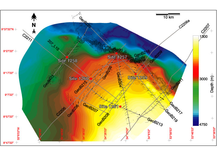
Figure F1.
Map of seismic cruise tracks. The bathymetry was derived from the seafloor pick of the seismic data and the Hydrosweep data acquired during the
Meteor
49-4 expedition.