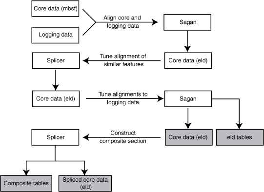
Figure F4.
Flow chart outlining process used to integrate the core and log data. mbsf = meters below seafloor. eld = equivalent logging depth.