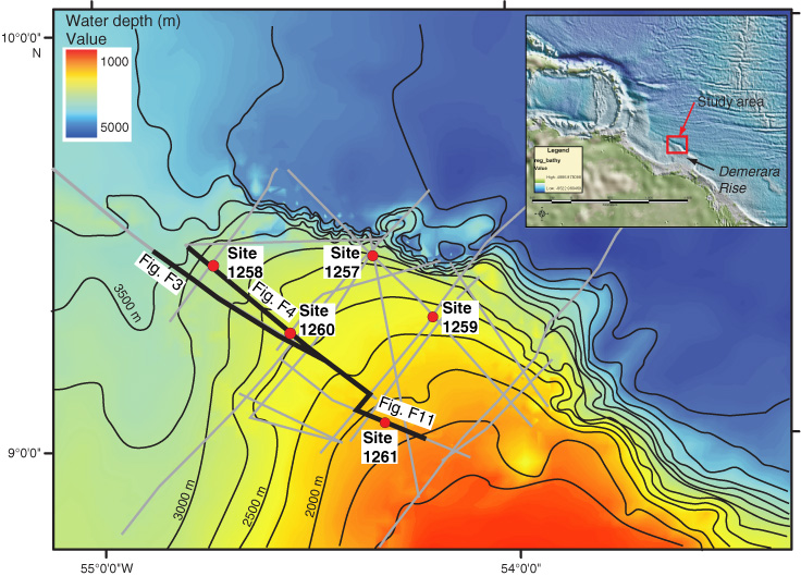
Figure F1.
Location map of outer Demerara Rise showing drill site locations and positions of seismic grid lines. Seismic lines used in subsequent figures are highlighted.