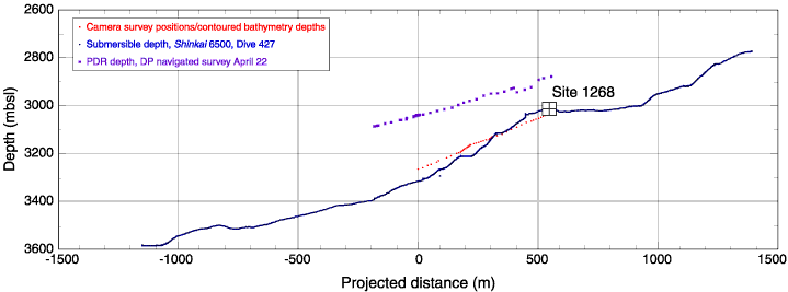
Figure F2. Comparison of data from the precision depth recorder (PDF) in the underway geophysics laboratory on board JOIDES Resolution, Shinkai 6500 Dive 427, projected along 315° with no vertical exaggeration, and depth information from video and sonar on the VIT frame during the camera survey on 22 May 2003. DP = dynamic positioning.


![]()