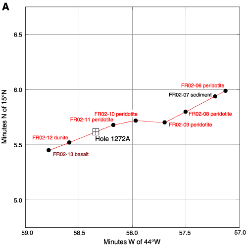
Figure F2. A. Location map with track of Faranaut Dive 2 (red line), locations and lithologies of samples from that dive, and the approximate position of Hole 1272A.
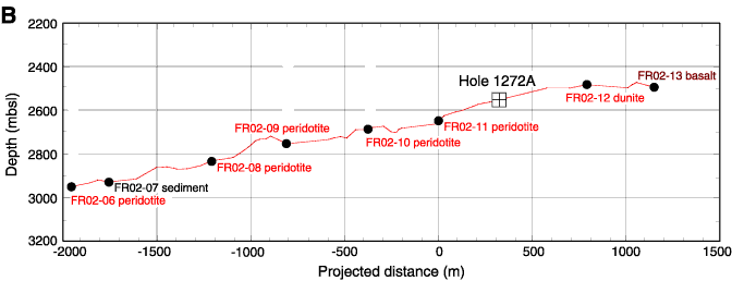
B. Bathymetric section based on Faranaut Dive 2,
projected along 248° with no vertical exaggeration. Locations and lithologies
of samples collected during the dive and the approximate position of Hole 1272A
are indicated.