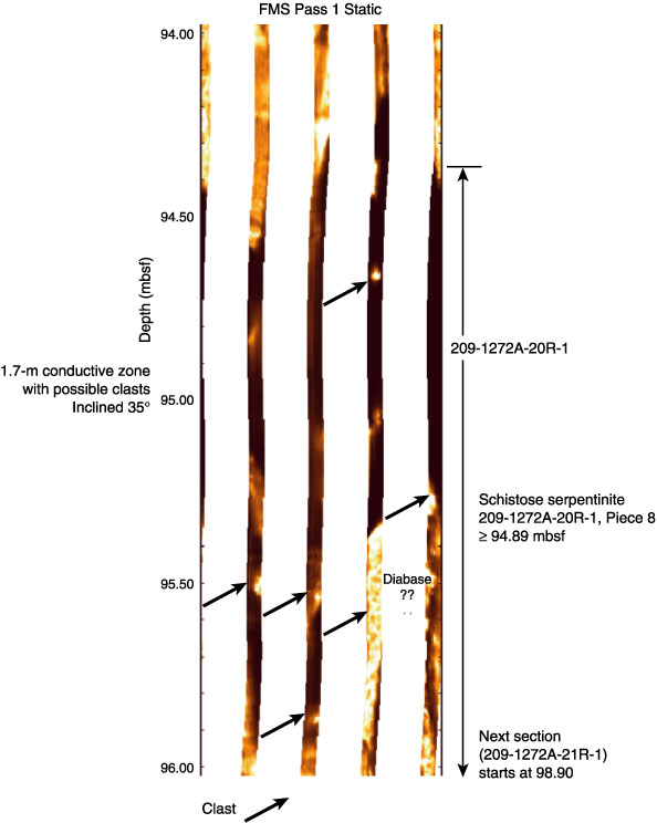
Figure F49. Formation MicroScanner (FMS) static image, from logging pass 1 of a 1.7-m conductive zone corresponding to the depth where a serpentine schist was recovered (Section 209-1272A-20R-1 [Piece 8]) at 94.89 mbsf (curated depth). The conductive zone associated with the schist may represent a gouge. Note resistive clasts in a conductive matrix (indicated by black arrows).