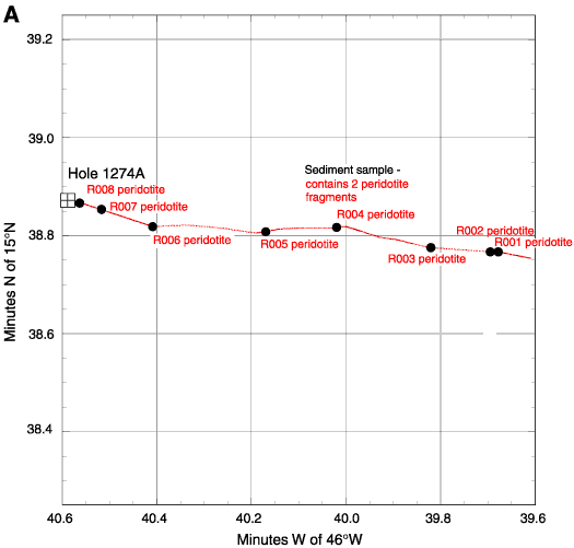
Figure F2. A. Location map with track of Shinkai 6500 Dive 416 (red dotted line), locations and lithologies of samples from that dive, and the approximate position of Hole 1274A.
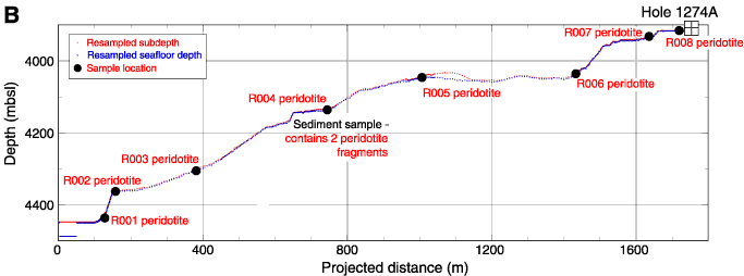
B. Bathymetric section based on Shinkai 6500 Dive 416,
projected along 278° with no vertical exaggeration. Locations and lithologies
of samples collected during the dive, as well as the approximate position of
Hole 1274A, are indicated.