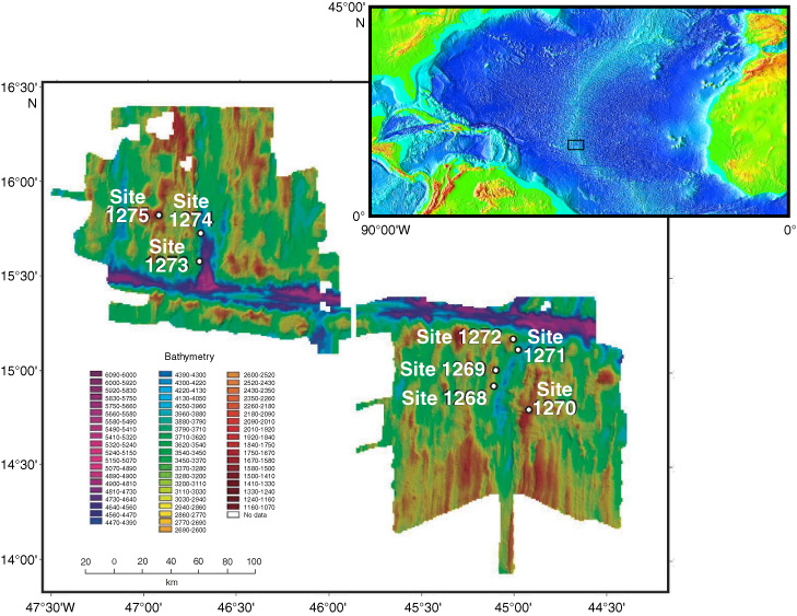
Figure F1. Mid-Atlantic Ridge bathymetry (base image from
www.ngdc.noaa.gov/mgg/image/2minrelief.html) with inset noting location of lower map of Leg 209 drill sites from Shipboard Scientific Party, 2004. Only samples from the southernmost site on the western wall of the Mid-Atlantic Ridge (Site 1268) are discussed in this paper.