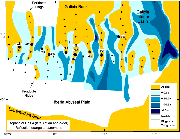
Figure F13. Isopach map of acoustic Unit 4 beneath the orange reflection on the Iberia margin. Sources are (1) the isopach map of acoustic Unit 4 by Réhault and Mauffret (1979) based on seismic data available in 1975; (2) MCS lines acquired in 1997 by the Maurice Ewing during the Iberian Seismic Experiment (ISE, Dale Sawyer, Principal Investigator), MCS line IAM 9 (Pickup et al., 1996), and MCS line Lusigal 12 (Beslier, 1996); (3) the Iberia Abyssal Plain (IAP) basement map (Shipboard Scientific Party, 1998) compiled from all available seismic data in the IAP; and (4) a detailed bathymetric map of the northeast Atlantic Ocean (Loubrieu et al., 2002). Locations of DSDP and ODP drill sites are shown by solid circles.


![]()